

The Site
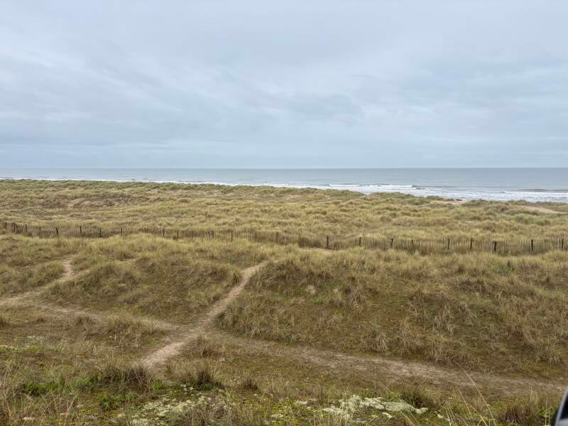
Winterton-on-Sea is a small coastal village on the Norfolk coast, a short distance from Great Yarmouth. With a population of roughly 1,500, it has a quiet, rural feel. It is best known for its wide sandy beach and the Winterton Dunes National Nature Reserve, which protects acidic dune habitat and rare wildlife, including a large grey seal colony that hauls out on the beach to pup between November and January. The village also has a long maritime history: its exposure to the North Sea has left many shipwrecks and coastal defences along the shoreline and in the water just offshore.
Why Lichen?
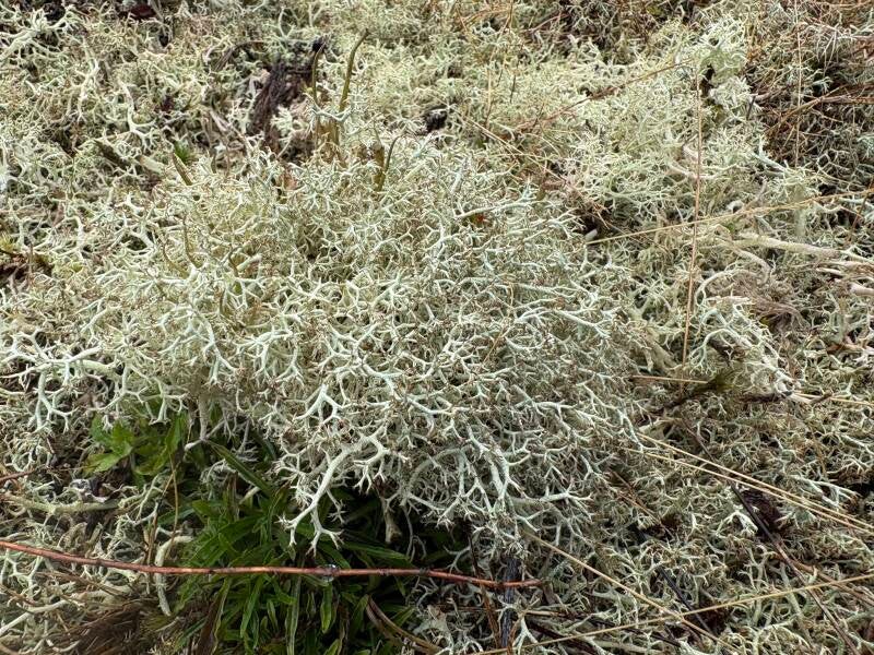
Lichens grow slowly and are easily damaged, which makes them a good indicator of how much disturbance an area is under. Our aim for the day was to measure how people and animals affect the lichen population on the dunes, particularly through trampling and the formation of desire paths. A desire path forms when people repeatedly choose the same route; over time the vegetation is trampled and dies back, leaving a worn line through the habitat. We defined a path as a strip of bare sand or soil, or of short grass and moss, that had clearly been trampled into a line.

Methods
We used two approaches.
- Transect from beach to dune. Starting at the border between the sandy beach and the rolling dunes, we threw a quadrat at random and recorded the height of the tallest plant, the percentage of bare ground and the number of species inside it. We then walked about 20 metres further into the dunes and repeated the process, until we had sampled 11 quadrats. Because the quadrat is divided into 20 squares, each square counted as 5% when estimating bare ground. Bare ground meant sand with no vegetation, including lichen and grass.
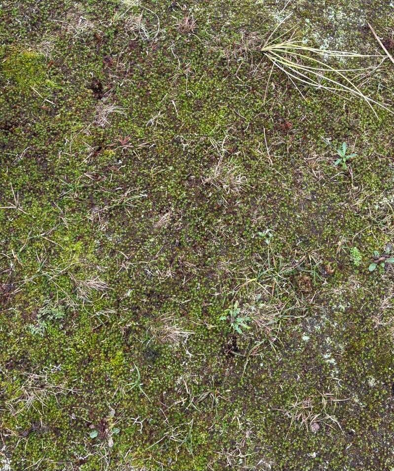
- Lichen intensity along a 16 metre line. At each of two sites (Place 1 and Place 2) we chose a spot at random, walked 16 metres forward and placed a quadrat every 50 cm, 32 quadrats in all. In each one we rated lichen intensity from 0 (none) to 10 (dense, undisturbed cover). At Place 2 we also photographed every quadrat so the change could be seen as well as measured. The photos below show what a 0, a 5 and a 10 looked like.


Results
Lichen Intensity
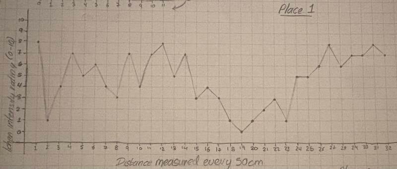
Place 1 was highly variable, with intensity changing a lot along the whole 16 metres. The 19th quadrat looks like it sits on a path, and the low ratings in the quadrats around it support that. The 2nd quadrat also scored just 1, but that may be down to a larger share of other vegetation crowding out the lichen rather than trampling.
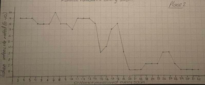
Place 2 was much more consistent at first, with quadrats 1 to 14 all rating between 7 and 10. Intensity then dropped sharply to 3 at quadrat 15, recovered to 8, and fell again to 0 for quadrats 20 to 22. It climbed briefly back to 3 before returning to 0 for the last four quadrats. These sharp drops probably mark well-worn paths.


Bare Ground
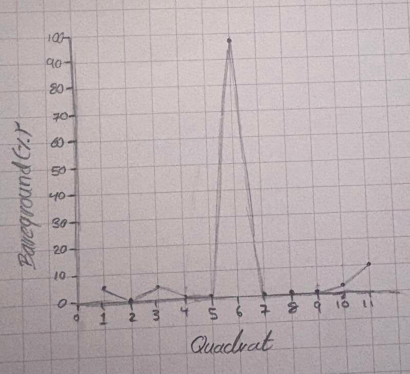
All but one of the 11 quadrats had 10% bare ground or less. The sixth was a clear outlier, with 98% bare sand.
Plant Height
The tallest plant in any quadrat was 48 cm, in the first, and the shortest was 9 cm, in the sixth. The average height of the tallest plant across the quadrats was 20.4 cm. Plants just outside the quadrats were often taller, so these figures may lean towards the short end. Tall plants were also sparse across the dunes, appearing in small clusters surrounded by much shorter, often trampled vegetation.
Species Count
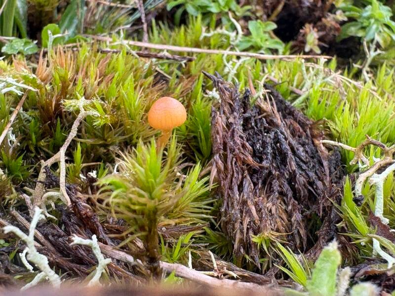
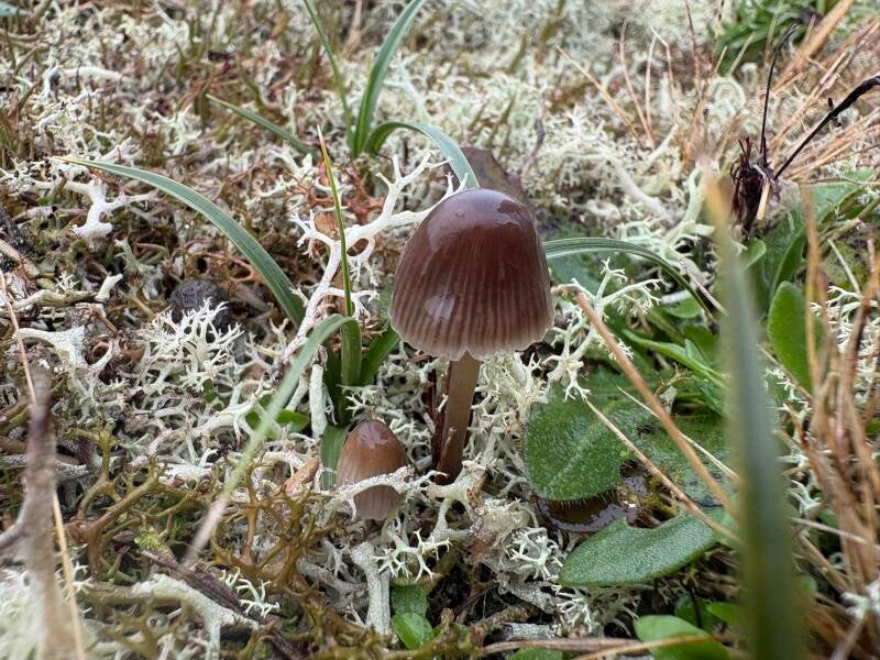
The first and tenth quadrats had the most species (11 each) and the sixth had the fewest (just 3). This matches the bare ground results: the sixth quadrat also had the most bare ground, at 98%. Across the quadrats we recorded several kinds of mushroom, moss and flowering plant, including Cat's-Ear (Hypochaeris Radicata).
Taken together, the sixth quadrat stands out on every measure: lowest species count, shortest tallest plant and almost no cover. It may be an area of heavy disturbance, though with one quadrat we can't say for certain whether trampling or natural exposure is the cause.
Cat's-Ear (Hypochaeris Radicata)


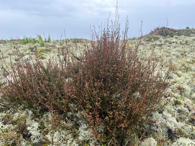
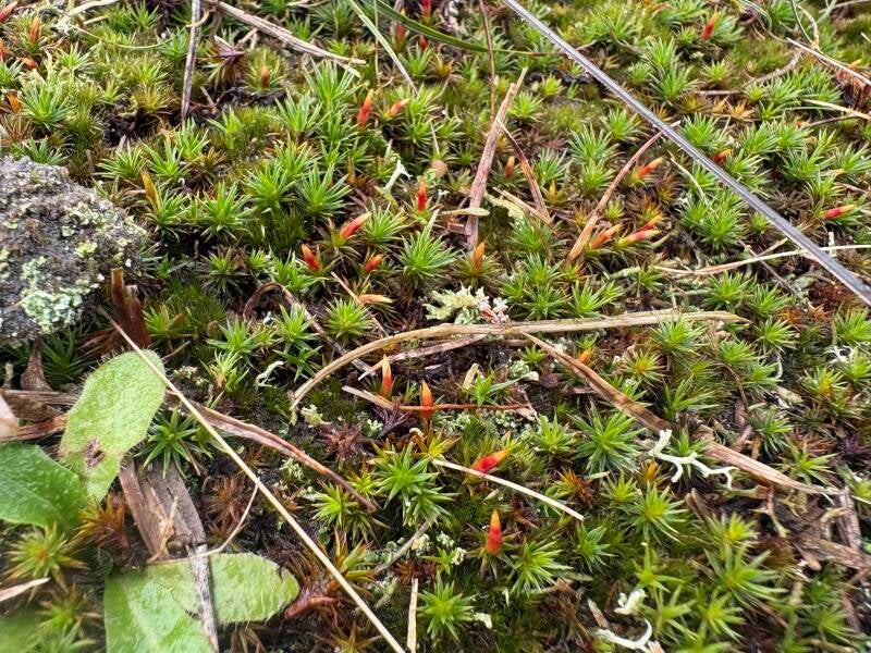
Other Vegetation in the Environment


How Could the Damage be Reduced?
The second part of the day was thinking about ways to reduce our impact on the dunes. I came up with three ideas, each with trade-offs.
- Closing the area to visitors. This would be the most effective way to protect the lichen and stop desire paths spreading. But it would stop people experiencing the landscape, and falling visitor numbers and interest could eventually put the area's funding at risk.
- Clearly marked paths. Making the council's official path stand out, for example with gravel like that used on the Dover cliffs coastal path, would encourage people to stay on it. A fence along the path would work even more strongly. Neither stops people and dogs from wandering off, though, and both change the natural look of the dunes, which could upset locals and affect wildlife.
- More signs and information. Signs explaining the damage caused by trampling, and where visitors should walk, might make people take more care. The risk is that they are ignored, and extra signs add clutter to a natural landscape.

Conclusion
Our results suggest that desire paths have a real effect on lichen at Winterton: where Place 2 drops to 0, it is very likely that people have been walking. The most promising approach is probably a combination, a clearly defined path backed up by a small amount of well-placed signage, rather than any single measure. With only 11 quadrats and two short lines, our sample is small, so a follow-up visit with more repeats would make the findings more reliable.
Create Your Own Website With Webador